Concept and creative process
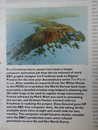
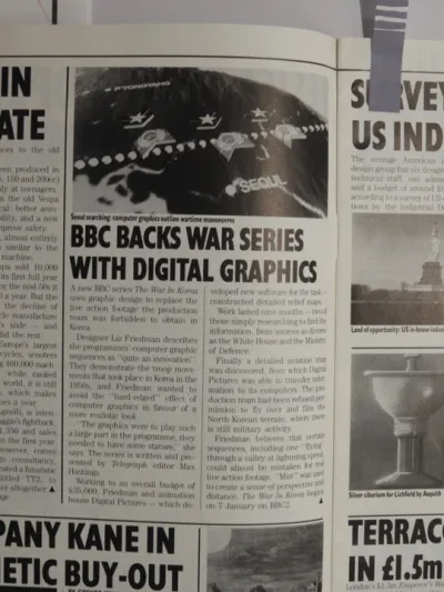
Map sequences for the documentary series 'The War in Korea'. Maps were required to show troop movements during the Korean War, which was fought from 1950-53, and to depict the topography of the landscape. The graphic sequences were to play an integral role within the programme, so it was important to be accurate and at the same time make the maps as interesting as possible. Months of research ensued, to find the information needed to model an accurate and detailed landscape of Korea, as it wasn't possible just to buy a detailed map of North Korea. Every possible source was contacted, from the White House to the Ministry of Defence. Finally a detailed aviation map of Korea was sourced from the Ministry of Defence, showing the height of mountains and other detailed data to enable us to build Korea on a computer exactly as it really is. Software was also specially written to depict mist and snow. This was a first for computer graphics, as was the detailed fly-through sequence of the snow-clad Hungnam Valley. By that time the production team had been refused permission to overfly and film, so they were doubly pleased that we had managed to create an accurate computer-generated model.
CGI was created by Peter Florence at Digital Image.
Idea Generation and Creative Direction - Liz Friedman.
More Information
The War in Korea press cuttings

The War in Korea press cutting 1
The War in Korea press cutting 2
The War in Korea press cutting 3